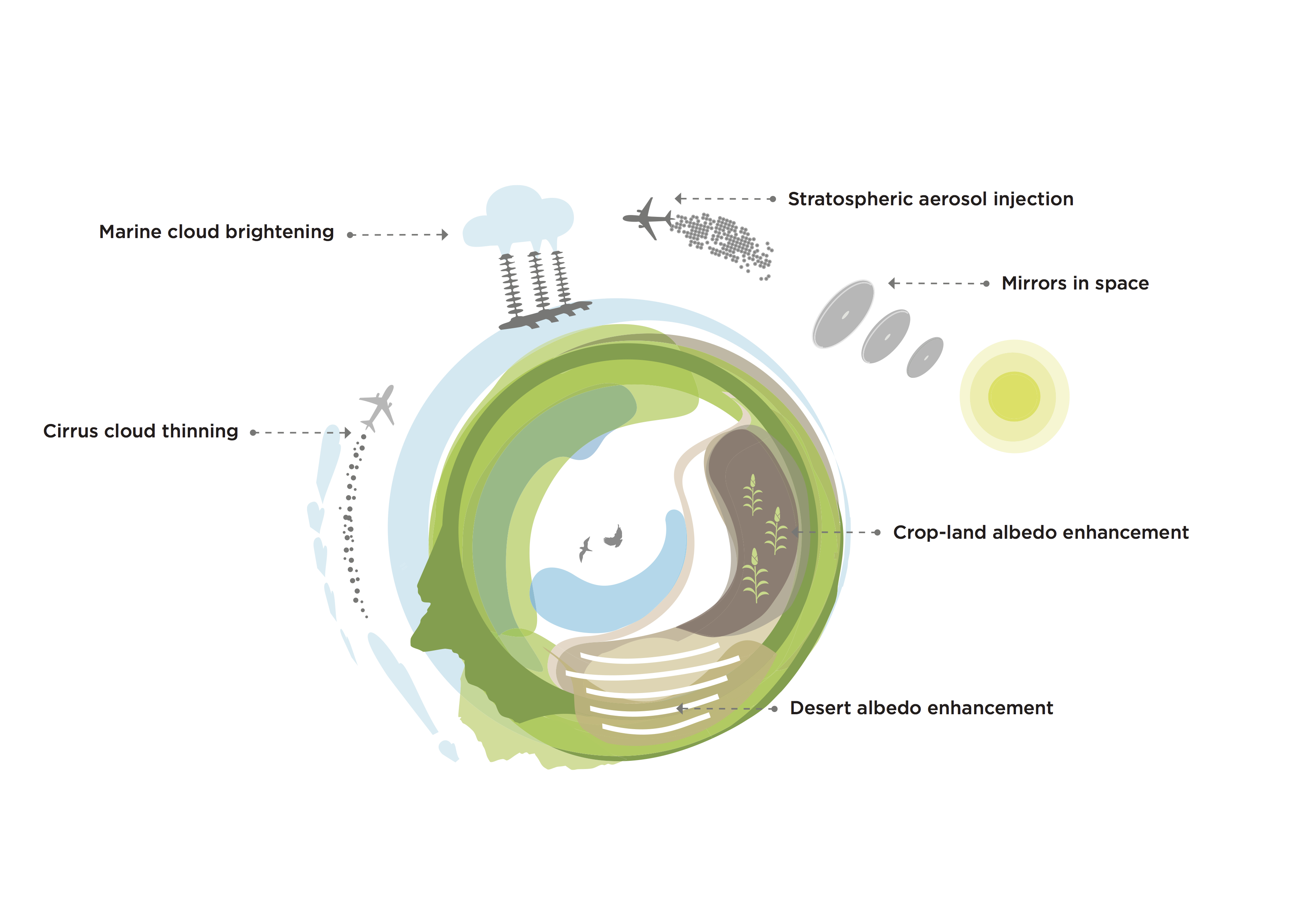
Research

Research Areas

Our research focuses on climate dynamics: understanding the response to perturbations in the climate system. We specialize in combining global climate, regional climate, and process model simulations with mathematical/engineering techniques to understand responses on a variety of temporal and spatial scales.

If you are interested in joining our group or working with us, please get in touch via the Contact page.

Geoengineering

Geoengineering describes a set of technologies designed to temporarily, deliberately modify the climate, preventing some of the worst effects of climate change while society ramps up greenhouse gas mitigation and carbon dioxide removal efforts.

What are the risks of doing climate engineering versus not doing it?  How do we know?  Are there certain climate objectives that climate engineering can meet, and are there objectives it can’t?

Would you like to know more?

Teleconnections  

Teleconnections

If a butterfly flaps its wings in New Mexico, could it cause a typhoon in China?  Probably not, but there are features in the climate system called teleconnections where a change in one region can cause effects halfway around the world. 

How can we quantify teleconnections?  How can we discover new ones?

Would you like to know more?

Emulators  

Emulators

Climate models are state-of-the-art tools, but sometimes you don’t need all of that complexity.  For example, what if you wanted to run a food model with different climate scenarios to understand changes and feedbacks?  A full climate model is overly complicated for that purpose and too expensive. 

So how do you build a simpler version of the climate model, and what does it need?  We call these simple models emulators, and they can cover a variety of spatial or temporal scales.

Would you like to know more?

Downscaling  

Dynamic downscaling

Climate models can provide projections of future climate change, but at horizontal resolutions of tens or hundreds of kilometers.  If you’re a mayor or a farmer, it’s difficult to turn that information into projections that can tell you about the risks you or your town are going to face.  Downscaling can turn that large-scale information into something that’s more fine scale. 

How well does it do?  What are the uncertainties?  For what variables (like temperature or precipitation) does it work?

Would you like to know more?